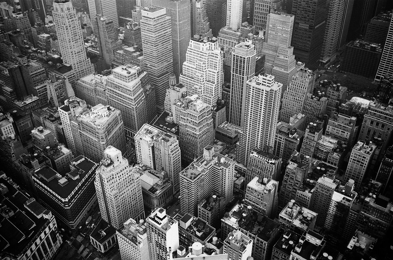
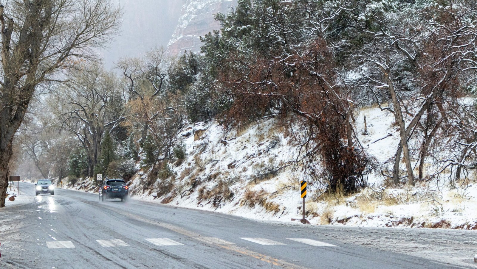
NEW YORK — A brutal Arctic front swept across the Tri-State on Tuesday, marking New York City’s first snowfall of the season and plunging millions into a sudden deep freeze. What began as a soft flurry over Central Park by dawn turned into a full-blown cold snap, dropping temperatures nearly 30 degrees in less than twelve hours and sending shivers down skyscrapers from Midtown to Manhattan’s Battery Park.
“This is the earliest measurable snow we’ve had in four years,” said Brian Ceballos, a meteorologist at the National Weather Service. “It’s not the amount that’s shocking — it’s the intensity of the cold. This air mass is straight out of the Arctic.”
The polar vortex — a swirling mass of freezing air typically locked near the North Pole — buckled southward over the weekend, unleashing gusts up to 45 mph across the U.S. East Coast. The cold front sliced through Pennsylvania and New Jersey overnight before slamming into New York City just after midnight.
🌨️ A City in Freeze Mode
By sunrise, temperatures hovered around 29°F — a chilling reality for commuters darting through icy sidewalks and wind-tunnel streets. Steam vents in Midtown erupted into ghostly clouds as taxis crawled through sleet-slick avenues. In Queens, residents awoke to thin sheets of frost on car windshields, while Staten Island saw its first legitimate coating of snow since last February.
“The wind came howling down my block like it owned the place,” laughed Terrence Harris, a Brooklyn doorman bundled in triple layers. “Even the pigeons looked confused.”
🚨 Freeze Warnings and Public Alerts
The National Weather Service issued a Freeze Warning for the entire Tri-State region until Wednesday morning, cautioning that wind chills could make temperatures feel as low as 20°F. City officials activated their Code Blue protocol, expanding homeless outreach and opening 36 additional warming centers across the five boroughs.
Mayor Eric Adams urged residents to check on elderly neighbors and to bring pets indoors. “New York may be the city that never sleeps,” Adams said in a statement, “but even we know when it’s time to get inside and warm up.”
🌬️ The Science Behind the Vortex
The polar vortex forms every winter high in the stratosphere over the Arctic. When that circulation weakens, icy air spills south. According to NOAA, this year’s early-season disruption was triggered by a chain reaction of jet-stream distortions linked to a persistent La Niña pattern in the Pacific. Those ripples split the vortex, sending a lobe of Arctic air directly toward the U.S. Northeast.
“It’s like a cracked bowl of cold air spilling into our latitudes,” explained Dr. Anika Patel of Columbia University’s Earth Institute. “Normally we see this in January or February — not before Thanksgiving. That’s what makes this event remarkable.”
🚇 MTA on Alert and City Response
Transit crews scrambled overnight to prevent icy rail switches and frozen doors. The MTA deployed de-icing trains on elevated tracks and staged salting teams at major bus depots. Subways ran on schedule Tuesday morning, though minor delays were reported along the 7 line due to wind-blown debris. The Port Authority confirmed that all three airports remained open, with limited runway de-icing at JFK.
“We’ve learned from storms past,” said Transit Chief Operations Officer John Renaldi. “It’s about staying ahead of the freeze, not reacting to it.”
☕ How New Yorkers Coped
Despite the biting wind, the city’s rhythm never faltered. Coffee shops in SoHo were packed with bundled-up commuters, and street vendors on 42nd Street wrapped gloved hands around hot pretzel stands. “This is the real New York energy,” said María Rodriguez, smiling under her scarf. “Complain about the cold, then keep hustling.”
Retailers reported a sudden surge in sales for gloves, scarves, and hand warmers. One Midtown clothing chain sold out of winter jackets before noon. Delivery apps logged record breakfast orders as office workers avoided venturing out for food. Uber and Lyft reported a 25 percent spike in ridership citywide.
🏙️ Frozen Beauty and Urban Challenges
Central Park’s trees shimmered under a light crust of snow, creating postcard-perfect scenes as joggers treaded cautiously along frosty paths. But beauty came with hazards — firefighters responded to multiple calls of burst outdoor pipes in the Bronx, while sanitation trucks pre-treated bridges and elevated roads with brine.
In Hoboken and Jersey City, commuters endured icy gusts off the Hudson River, prompting ferry operators to add extra de-icing crews. “It’s pretty until your face goes numb,” joked Lisa Han, a Hoboken resident snapping photos of the skyline under the morning snow haze.
🌡️ The Week Ahead
Meteorologists predict the cold will persist through the weekend, with another chance of light snow Friday night. Daytime highs are expected to hover in the upper 30s, about 10 degrees below normal for mid-November. The polar vortex’s southern reach is expected to weaken early next week, restoring milder conditions by Sunday.
“This is the pattern’s first act,” warned Dr. Patel. “If the Arctic oscillation stays negative, we could see more early snow events in December.”
💡 Expert Opinions and Climate Context
Climate scientists emphasize that single weather events don’t prove or disprove climate change — but the frequency of polar intrusions has risen in recent years. “It’s counterintuitive, but a warming Arctic can destabilize the jet stream,” explained Dr. Marcus Feldman of NOAA. “That allows cold air to dive south more often, producing extremes like we’re seeing now.”
Environmental analysts say infrastructure resilience — from subway pumps to electrical grids — will be critical as the region faces more abrupt weather swings. The city’s Climate Mobilization Act includes new cold-weather adaptation targets slated for 2026.
🏢 Economic Ripple Effects
The sudden temperature plunge had a noticeable economic footprint. Construction crews across Manhattan halted outdoor operations due to frost-slick scaffolds and safety concerns. Local diners and delivery businesses, however, thrived as residents sought warm comfort food. “We sold triple our usual soup orders,” laughed Nina O’Donnell, owner of a Brooklyn café. “Cold weather makes everyone crave chowder.”
Energy companies warned that natural-gas consumption jumped 18 percent overnight as furnaces roared to life. Analysts predict a short-term rise in heating-oil prices if the cold pattern lingers. Economists at JPMorgan Research estimate that every 10-degree temperature drop across the Northeast adds roughly $45 million a day in regional energy demand.
🚔 Safety and Emergency Response
Hospitals in the Bronx and Newark reported a modest increase in cold-related cases, mainly minor frostbite and slips on icy sidewalks. The FDNY urged residents to use approved space heaters only on grounded outlets, after responding to several small apartment fires linked to faulty wiring. Meanwhile, animal-rescue shelters coordinated late-night patrols to collect stray pets left outdoors.
Snow-removal crews deployed pre-dawn to salt overpasses and bridges. “We’re treating this like a rehearsal for January,” said Sanitation Commissioner Lori Brown. “Better to over-prepare now than scramble later.”
📊 How the Tri-State Compared
New Jersey’s inland towns like Morristown saw light accumulation, while coastal areas mainly endured sleet. Connecticut’s northwest hills measured up to two inches by midday. Power outages were minimal, though gusts toppled tree limbs in Westchester County. In total, fewer than 2,000 customers lost power region-wide — a far cry from the crippling ice storm of 2022.
🧣 Community Spirit and Small Moments
Amid the freeze, small acts of kindness warmed hearts. Volunteers at St. Mark’s Church distributed thermal blankets to unhoused residents. Kids in Queens built tiny snowmen outside apartment courtyards before school buses arrived. “It might be cold, but New York always finds its warmth,” said teacher Elaine Gomez, watching her students catch flakes on their tongues.
Across social media, #NYCSnow and #PolarVortex2025 trended through the morning. Drone footage of the frosted skyline drew millions of views within hours, while meteorologists live-streamed temperature drops from rooftop sensors overlooking Times Square.
🌎 Wider Weather Picture
The same Arctic system stretched down the East Coast to Virginia, setting record lows in Philadelphia and Washington D.C. Meteorologists described the event as a “preview of an unsettled winter.” The U.S. Climate Prediction Center projects colder-than-average conditions for the Northeast through January 2026, with periodic warm breaks as the jet stream oscillates northward.
🎓 What Experts Say About Future Winters
Scientists caution that as Arctic sea-ice coverage diminishes, atmospheric instability will continue to intensify. “When the pole warms faster than the mid-latitudes, the boundary between them weakens,” said Dr. Feldman. “That boundary — the jet stream — is our gatekeeper. A wavier jet means more extremes on both sides: sudden warmth and sudden cold.”
City planners are already adjusting building codes to address both heat waves and cold snaps. Insulation standards, heating-system efficiency, and backup-power capacity are being reviewed in anticipation of similar shocks.
💬 Voices From the Streets
Despite the freeze, many residents saw beauty in the disruption. “It’s like the city paused for a moment,” said photographer Levi Chen, who captured dawn shots of snow swirling between skyscrapers. “The air felt quiet, like the city was holding its breath.”
Tourists from Florida and Texas treated the flurries as a novelty. “First time seeing snow!” laughed Carmen Diaz, spinning on the steps of the New York Public Library. For lifelong New Yorkers, it was more nostalgia than excitement — the first sign of a holiday season just around the corner.
🔭 Looking Ahead
Forecasters expect another Arctic front around Thanksgiving week, though not as strong. Still, officials urge residents to restock emergency kits, check heating systems, and sign up for weather alerts. “Winter has arrived early,” Dr. Wu said. “Consider this the opening act.”
🌆 Reflections on Resilience
The early freeze reaffirmed what New Yorkers already know: the city endures. From wind-whipped commuters to tireless transit crews, everyone adapted within hours. It’s a rhythm forged through countless storms — snow, rain, or crisis — and it beats stronger each year. As daylight faded behind a glittering skyline, thin snow layers still clung to park benches, glowing under streetlights like sugar dust on steel.
In Short :
- The Tri-State area saw its first snow of the 2025-26 season as a polar-vortex surge sent Arctic air into New York, New Jersey and Connecticut.
- Temperatures plunged to the 20s °F with wind chills near 15 °F, prompting freeze warnings and emergency shelters.
- MTA, city services, and energy providers activated winter protocols; minor travel delays but no major outages reported.
- Experts link the early cold to jet-stream disruptions amplified by La Niña and Arctic warming trends.
Q&A : Understanding the Polar Vortex Event
Q1. What exactly is the polar vortex?
A vast area of low-pressure, cold air surrounding the Arctic. When it weakens, frigid air can escape southward into North America, causing sudden freezes.
Q2. Why did it hit so early this year?
Meteorologists cite jet-stream disruptions tied to La Niña conditions and rapid Arctic warming that destabilized the vortex earlier than usual.
Q3. Will it snow again soon?
Light flurries are possible later in the week; larger storms may follow in December as the pattern repeats.
Q4. Is this because of climate change?
Scientists say no single event proves climate change, but warming at the poles can create more frequent jet-stream swings, increasing extreme cold outbreaks.
Q5. How can residents prepare?
Insulate windows, check heating systems, carry emergency car kits, and stay informed through the NWS and NotifyNYC alerts.
Q6. How long will the freeze last?
Temperatures will stay below seasonal averages through the weekend, with gradual warming expected by early next week.
Q7. What’s the broader impact on energy costs?
Short cold waves typically raise short-term energy prices, but sustained vortex events can strain supply chains and increase winter bills by 5–10 percent.
Q8. Could this happen again this winter?
Yes — meteorologists say multiple weaker vortex displacements are possible through February 2026.
Sources : National Weather Service, NOAA Climate Prediction Center, Reuters, Associated Press, New York Post, and NewsSparq editorial reporting.


Leave a Reply